
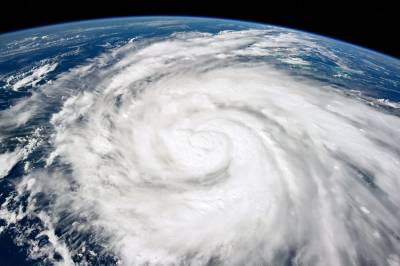
As Hurricane Ian demolished swaths of Florida after making landfall Wednesday, the storm also renewed debates over the connection between hurricanes and climate change. Commentary fell into predictable partisan ruts.
“If Republicans have anything to do” with climate policy in Florida, “we can kiss Palm Beach goodbye,” Ryan Cooper wrote for The American Prospect under the headline “The Climate Dystopia Is Already Here.” Meanwhile, Fox News cited the executive director of a Trump-friendly think tank to lay into Democrats for politicizing the tragedy “to promote their green agenda.”
In reality, the science of hurricanes is more nuanced than many realize, with near-unanimous agreement on some topics and question marks elsewhere. From the areas with the most scientific consensus to those with less, here’s what we know—and what we don’t.
Hurricanes are getting wetter.
Climate change is making hurricanes rainier. With higher temperatures, “you just have more water vapor going up and condensing in the clouds, so you have more rain coming down,” Kerry Emanuel, a meteorologist at MIT, explained. “It’s really that simple.”
Hurricane Ian is producing at least 10 percent more rain than it would in a world without climate change, according to calculations by Michael Wehner, a senior scientist at Lawrence Berkeley National Laboratory, and Kevin Reed, a professor at Stony Brook University, who used peer-reviewed methods (though their study itself was not peer-reviewed).
“Water is by far the biggest killer and source of damage in hurricanes,” Emanuel noted. But hurricanes are categorized according to wind speed, not rainfall, which can create potentially deadly confusion.
Intense Category 4 hurricanes are dramatic, but “you can have a Cat 1 or a tropical storm that kills a lot of people because it dumps a huge amount of rain,” Emanuel said.
In addition to freshwater flooding from rain, hurricanes also bring saltwater storm surges inland, which climate change has exacerbated via elevated sea levels (since 1960, the relative sea level on Florida’s west coast has risen by about 6-8 inches, according to the EPA). Storm surges caused by hurricane winds are starting from a higher baseline. It’s also possible, though not certain, that the storm surges themselves are getting bigger.
Hurricanes are (probably) getting more intense.
When Ian made landfall in Florida on Wednesday, it was a Category 4 storm with sustained winds of 150 mph. That put it in an eight-way tie for the fifth-strongest hurricane to hit the continental U.S.
Before reaching Florida territory, it also experienced two periods where it met the arbitrary threshold for “rapid intensification,” with wind speeds increasing by 35 miles per hour over a 24-hour period. A 2019 study suggests that the rate of intensification of tropical cyclones has increased, at least in the North Atlantic.
Hurricane intensity—which Florida State University professor Allison Wing describes as a “speed limit” for hurricane winds—is likely increasing as a result of climate change. Hurricanes get their energy from “fluxes of heat from the sea surface to the atmosphere,” she said. The warmer the water, the higher the “speed limit” and the faster the winds can get.
According to the National Oceanographic and Atmospheric Administration (NOAA), “more than 90 percent of the warming that has happened on Earth over the past 50 years has occurred in the ocean”—which suggests that, in general, the hurricane speed limit has been ticking upward.
Research tends to support that projection. A 2021 study led by Tom Knutson of NOAA found that storm intensity has increased over the past four decades and is expected to continue to do so under warming climate conditions. But Knutson and his coauthors noted that “it is not clear” how much of the increase is due to human-caused climate change as opposed to “natural variability.”
Wehner shared a similar sentiment. He thinks a greater proportion of hurricanes will be more intense in the future. But there is “less consensus on whether or not we actually already have detected that,” he said.
“I’m being perhaps overly conservative. Because that’s what scientists do.”
Hurricane data is still spotty.
Major storms are increasingly common in the North Atlantic—but there’s still a lot we don’t know.
“If you look at the overall frequency of storms, it’s going to be completely dominated by weak storms that don’t do a lot of damage,” Emanuel said. “So what you ought to be asking is how does the frequency of category 3, 4, and 5 storms change with climate?”
The number of “major” hurricanes—categories 3, 4, and 5—has increased in the North Atlantic since the 1980s, but not because of greenhouse gas emissions. In fact, some of our hurricane woes are a byproduct of having cleaned up the environment.
In the past, the U.S. and Europe emitted more aerosols. Unlike greenhouse gasses, which disperse over the entire globe and trap heat in the atmosphere, aerosol particles are more localized to particular regions and artificially cool the earth by partially blocking sunlight. When air pollution was more widespread in the U.S. and Europe, aerosols kept Atlantic ocean water cooler, making hurricanes less likely. Since the implementation of clean air laws, largely in the 1970s, things have changed.
In a 2020 study, James Kossin examined nearly 40 years of data and found that while roughly 15 percent of tropical cyclones (hurricanes are a subcategory of cyclones) in the North Atlantic could be considered major hurricanes in 1979, that number was nearly 40 percent by 2017.
But there’s still much scientists don’t know. Tropical cyclone frequency varies by region. One recent study found that global hurricane counts have significantly decreased from 1990 to 2021—but much of that decline can be attributed to “La Niña-like” changes in the Pacific Ocean. In the Atlantic, hurricanes are still going strong.
Scientists also face limits in the years for which they have data. Old, pre-satellite meteorological data—basically, any time before 1980—is spotty.
But even post-satellite data can only go so far. Scientists send aircraft into storms to gauge wind speed only for the roughly one-third of storms in the Atlantic that threaten the United States.
“Globally, we’re doing a really, really poor job observing tropical cyclones,” Emanuel said. “It’s kind of shocking actually. We see all of them with satellites these days, and that’s fine … but it’s really hard to know how strong the storm is by looking at a picture.”


Please note that we at The Dispatch hold ourselves, our work, and our commenters to a higher standard than other places on the internet. We welcome comments that foster genuine debate or discussion—including comments critical of us or our work—but responses that include ad hominem attacks on fellow Dispatch members or are intended to stoke fear and anger may be moderated.
With your membership, you only have the ability to comment on The Morning Dispatch articles. Consider upgrading to join the conversation everywhere.